1.JPG)
.JPG)
.JPG)
.JPG)
.JPG)
.JPG)
.JPG)
| Podolobium alpestre | Podolobium alpestre | |
|
|
|
|
| Description:Flowers | Description:Flowers and leaves | |
| Location:Mt Cope, Falls Creek,Victoria | Location:Mt Cope, Falls Creek, Victoria | |
| GPS coordinates:36˚55.309S, 147˚17.763E | GPS coordinates:36˚55.617S, 147˚16.888E | |
| Date:19 January 2012 | Date:12 February 2014 | |
| Field No.:U519 | Field No.:2417 | |
| Podolobium alpestre | Podolobium alpestre | |
|
|
|
|
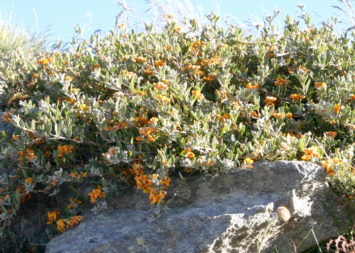
| Description:Plant on rock | Description: Flowers | |
| Location:Falls Creek, Victoria | Location:Falls Creek, Victoria | |
| GPS coordinates:N/A | GPS coordinates:N/A | |
| Date:6 January 2009 | Date:6 January 2009 | |
| Field No.:U520 | Field No.:U520 | |
| Podolobium alpestre | Podolobium alpestre | |
|
|
|
|
| Description:Flowers | Description:Flowers | |
| Location:Mt Cope, Falls Creek, Victoria | Location:Mt Cope, Falls Creek, Victoria | |
| GPS coordinates:36˚55.617S, 147˚16.888E | GPS coordinates:36˚55.617S, 147˚16.888E | |
| Date:12 February 2014 | Date:12 February 2014 | |
| Field No.:2417 | Field No.:2417 | |
| Podolobium alpestre | Podolobium alpestre | |
|
|
|
|
| Description:Flowers | Description:Plant | |
| Location:The Horn, Mt Buffalo, Victoria | Location:The Horn, Mt Buffalo, Victoria | |
| GPS coordinates:36˚43.072S, 146˚48.112E | GPS coordinates:36˚43.072S, 146˚48.112E | |
| Date:1 January 2017 | Date:1 January 2017 | |
| Field No.:5824 | Field No.:5824 | |
References (accessed 26 January 2017):
|
Murphy J. & Dowling B., (2012), Plants of the Victorian High Country, A Field Guide for Walkers, CSIRO Publishing
http://plantnet.rbgsyd.nsw.gov.au/cgi-bin/NSWfl.pl?page=nswfl&lvl=sp&name=Podolobium~alpestre
|
Image use policy 
This work is licensed under a
Creative Commons Attribution-Noncommercial 2.5 Australia License.
Page created 5 November 2012
Page edited 10 February 2016
© Roger Fryer and Jill Newland 2012 - 2017