.JPG)
.JPG)
.JPG)
.JPG)
.JPG)
.JPG)
.JPG)
.JPG)
.JPG)
.JPG)
.JPG)
.JPG)
.JPG)
| Goodenia ramelii | Goodenia ramelii | |
|
|
|
|
| Description:Flower | Description:Flower | |
| Location:100K W of Barkly Homestead, Northern Territory | Location:63K E of Barkly Homestead, Northern Territory | |
| GPS coordinates: 20˚04.8910S 136˚48.1190E | GPS coordinates:19˚55.4430S 136˚22.8720E | |
| Date of photo:24 September 2018 | Date of photo:2 September 2016 | |
| Field No.: 6733 | Field No.: 5693 | |
| Goodenia ramelii | Goodenia ramelii | |
|
|
|
|
| Description:Flower | Description:Plant | |
| Location:63K E of Barkly Homestead, Northern Territory | Location:Finke, Northern Territory | |
| GPS coordinates:19˚55.4430S 136˚22.8720E | GPS coordinates:N/A | |
| Date of photo:2 September 2016 | Date of photo:23 June 2007 | |
| Field No.: 5693 | Field No.: U306 | |
| Goodenia ramelii | Goodenia ramelii | |
|
|
|
|
| Description:Flowers | Description:Flower - side view | |
| Location:63K E of Barkly Homestead, Northern Territory | Location:63K E of Barkly Homestead, Northern Territory | |
| GPS coordinates:19˚55.4430S 136˚22.8720E | GPS coordinates:19˚55.4430S 136˚22.8720E | |
| Date of photo:2 September 2016 | Date of photo:2 September 2016 | |
| Field No.: 5693 | Field No.: 5693 | |
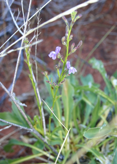
| Goodenia ramelii | Goodenia ramelii | |
|
|
|
|
| Description:Flower spike | Description:Plant in habitat | |
| Location:63K E of Barkly Homestead, Northern Territory | Location:63K E of Barkly Homestead, Northern Territory | |
| GPS coordinates:19˚55.4430S 136˚22.8720E | GPS coordinates:19˚55.4430S 136˚22.8720E | |
| Date of photo:2 September 2016 | Date of photo:2 September 2016 | |
| Field No.: 5693 | Field No.: 5693 | |
| Goodenia ramelii | Goodenia ramelii | |
|
|
|
|
| Description:Flower spike | Description:Flower spike | |
| Location:100K W of Barkly Homestead, Northern Territory | Location:100K W of Barkly Homestead, Northern Territory | |
| GPS coordinates: 20˚04.8910S 136˚48.1190E | GPS coordinates: 20˚04.8910S 136˚48.1190E | |
| Date of photo:24 September 2018 | Date of photo:24 September 2018 | |
| Field No.: 6733 | Field No.: 6733 | |
| Goodenia ramelii | Goodenia ramelii | |
|
|
|
|
| Description:Flowers, buds and pods | Description:Basal rosette | |
| Location:100K W of Barkly Homestead, Northern Territory | Location:100K W of Barkly Homestead, Northern Territory | |
| GPS coordinates: 20˚04.8910S 136˚48.1190E | GPS coordinates: 20˚04.8910S 136˚48.1190E | |
| Date of photo:24 September 2018 | Date of photo:24 September 2018 | |
| Field No.: 6733 | Field No.: 6733 | |
| Goodenia ramelii | Goodenia ramelii | |
|
|
|
|
| Description:Basal leaves | Description:Plant in habitat | |
| Location:100K W of Barkly Homestead, Northern Territory | Location:100K W of Barkly Homestead, Northern Territory | |
| GPS coordinates: 20˚04.8910S 136˚48.1190E | GPS coordinates: 20˚04.8910S 136˚48.1190E | |
| Date of photo:24 September 2018 | Date of photo:24 September 2018 | |
| Field No.: 6733 | Field No.: 6733 | |
References (accessed 29 January 2019):
Image use policy 
This work is licensed under a
Creative Commons Attribution-Noncommercial 2.5 Australia License.
Page created 27 April 2013
Page edited 5 February 2019
© Roger Fryer and Jill Newland 2013 - 2019