.jpg)
.jpg)
.jpg)
.jpg)
| Nicotiana velutina | Nicotiana velutina | |
|
|
|
|
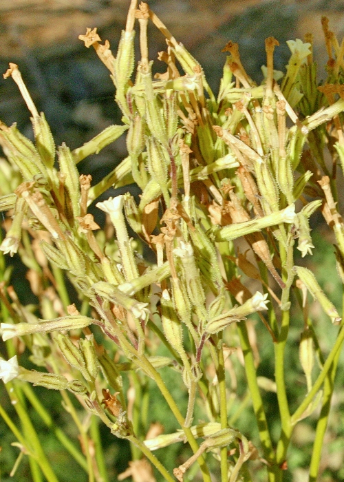
| Description:Flower | Description:Flowers | |
| Location:Birdsville Track, South West Queensland | Location:Birdsville Track, South West Queensland | |
| GPS coordinates:26˚20.0590S, 139°29.5760E | GPS coordinates:26˚20.0590S, 139°29.5760E | |
| Date:6 August 2012 | Date:6 August 2012 | |
| Field No.:1119 | Field No.:1119 | |
| Nicotiana velutina | Nicotiana velutina | |
|
|
|
|
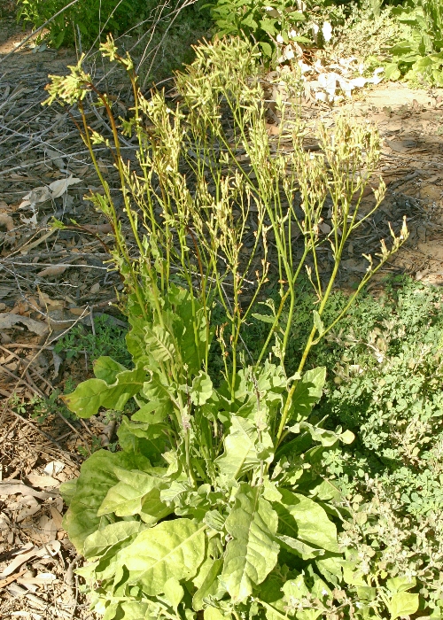
| Description:Plant on roadside | Description:Flowers | |
| Location:Birdsville Track, South West Queensland | Location:Birdsville Track, South West Queensland | |
| GPS coordinates:26˚20.0590S, 139°29.5760E | GPS coordinates:26˚20.0590S, 139°29.5760E | |
| Date:6 August 2012 | Date:6 August 2012 | |
| Field No.:1119 | Field No.:1119 | |
| Nicotiana velutina | Nicotiana velutina | |
|
|
|
|
| Description:Plant in habitat | Description:Flowers | |
| Location, Eyre Creek,Simpson Desert, South West Queensland | Location, Eyre Creek,Simpson Desert, South West Queensland | |
| GPS coordinates:25˚54.0250S, 138°51.1763E | GPS coordinates:25˚54.0250S, 138°51.1763E | |
| Date:18 June 2007 | Date:18 June 2007 | |
| Field No.:U985 | Field No.:U985 | |
References (accessed 19 January 2018):
Image use policy 
This work is licensed under a
Creative Commons Attribution-Noncommercial 2.5 Australia License.
Page created 19 January 2018
Page edited 23 January 2018
© Roger Fryer and Jill Newland 2018