.JPG)
.JPG)
.JPG)
.JPG)
.JPG)
.JPG)
.JPG)
.JPG)
.JPG)
.JPG)
.JPG)
| Tacca leontopetaloides | Tacca leontopetaloides | |
|
|
|
|
| Description:Flowers | Description:Plant | |
| Location:Earl Hill, Trinity Park, North Queensland | Location:Earl Hill, Trinity Park, North Queensland | |
| GPS coordinates:16˚47.7408S, 145°42.0210E | GPS coordinates:16˚47.7408S, 145°42.0210E | |
| Date of photo:29 January 2017 | Date of photo:29 January 2017 | |
| Field No.:5979 | Field No.:5979 | |
| Tacca leontopetaloides | Tacca leontopetaloides | |
|
|
|
|
| Description:Plant | Description:Plant in habitat | |
| Location:Earl Hill, Trinity Park, North Queensland | Location:Earl Hill, Trinity Park, North Queensland | |
| GPS coordinates:16˚47.7408S, 145°42.0210E | GPS coordinates:16˚47.7408S, 145°42.0210E | |
| Date of photo:29 January 2017 | Date of photo:29 January 2017 | |
| Field No.:5979 | Field No.:5979 | |
| Tacca leontopetaloides | Tacca leontopetaloides | |
|
|
|
|
| Description:Flowerheads | Description:Fruit | |
| Location: Davies Creek Lookout, North Queensland | Location: Davies Creek Lookout, North Queensland | |
| GPS coordinates:17˚00.593S 145˚34.948E | GPS coordinates:17˚00.593S 145˚34.948E | |
| Date of photo:22 February 2015 | Date of photo:22 February 2015 | |
| Field No.:3012 | Field No.:3012 | |
| Tacca leontopetaloides | Tacca leontopetaloides | |
|
|
|
|
| Description:Flower head | Description:Plant in-situ | |
| Location: Davies Creek Lookout, North Queensland | Location: Davies Creek Lookout, North Queensland | |
| GPS coordinates:17˚00.593S 145˚34.948E | GPS coordinates:17˚00.593S 145˚34.948E | |
| Date of photo:22 February 2015 | Date of photo:22 February 2015 | |
| Field No.:3012 | Field No.:3012 | |
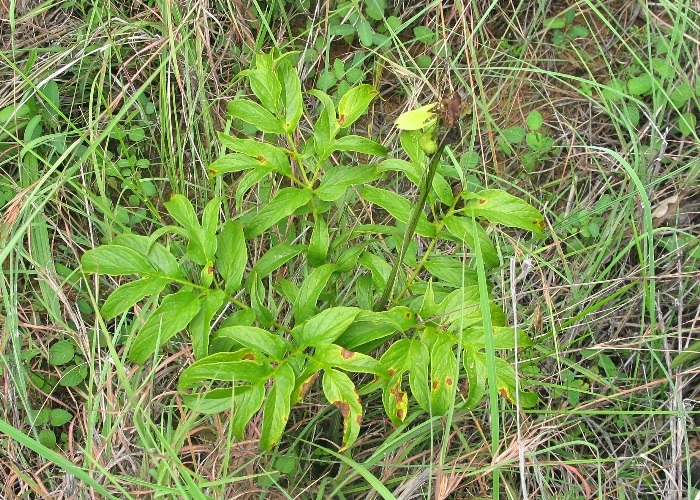
| Tacca leontopetaloides | Tacca leontopetaloides | |
|
|
|
|
| Description:Flower head | Description:Plant | |
| Location: Davies Creek Lookout, North Queensland | Location:Petford, North Queensland | |
| GPS coordinates:17˚00.593S 145˚34.948E | GPS coordinates:N/A | |
| Date of photo:22 February 2015 | Date of photo:25 January 2009 | |
| Field No.:3012 | Field No.:U666 | |
| Tacca leontopetaloides | Tacca leontopetaloides | |
|
|
|
|
| Description:Plant in habitat with seed pods | Description:Plant in habitat with Curcuma australasicus | |
| Location:Bamaga, North Queensland | Location:Bamaga, North Queensland | |
| GPS coordinates:10˚530.7605S 142˚22.8936E | GPS coordinates:10˚530.7605S 142˚22.8936E | |
| Date of photo:23 March 2015 | Date of photo:23 March 2015 | |
| Field No.:3043 | Field No.:3043 |
References (accessed 18 February 2017):
Image use policy 
This work is licensed under a
Creative Commons Attribution-Noncommercial 2.5 Australia License.
Page created 14 March 2015
Page edited 18 September 2017
© Roger Fryer and Jill Newland 2015 - 2017