|
|
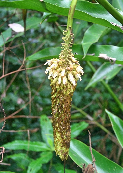
Pleuranthodium racemigerum |
Pleuranthodium racemigerum
|
| |
|
.JPG) |
.JPG) |
|
|
Description: Flowers |
Description: Plant |
| |
|
Location:Crawford's
Lookout, Palmerston Highway, North Queensland |
Location:Crawford's
Lookout, Palmerston Highway, North Queensland |
| |
|
GPS coordinates: 17˚36.5367S
145˚47.5555E |
GPS coordinates: 17˚36.5367S
145˚47.5555E |
|
|
Date:6
April 2008 |
Date:6
April 2008 |
| |
|
Field
No.:U834 |
Field No.:U834 |
| |
|
|
|
| |
|
Pleuranthodium racemigerum
|
Pleuranthodium racemigerum
|
| |
|
 |
.JPG) |
| |
|
Description: Flower spike |
Description:
Fruit |
| |
|
Location:Crawford's
Lookout, Palmerston Highway, North Queensland |
Location:
Mt Lewis National Park, North Queensland |
| |
|
GPS coordinates: 17˚36.5367S
145˚47.5555E |
GPS coordinates: 16˚35.7583S
145˚16.4867E |
| |
|
Date:6
April 2008 |
Date:14 May
2014 |
| |
|
Field
No.:U834 |
Field No.:
2501 |
| |
|
|
|
